
The Newspaper of Record since 1878
As an outdoor-loving newbie to the Copper Corridor, I’ve been asking long-time locals about their favorite hikes in the area. One of my coworkers suggested the Apache Tears Mine Trail in Superior as an easy walk that combined great scenery, Wild West history and opportunities for rockhounding.
This item is available in full to subscribers.
To continue reading, you will need to either log in to your subscriber account, below, or purchase a new subscription.
Please log in to continue |
As an outdoor-loving newbie to the Copper Corridor, I’ve been asking long-time locals about their favorite hikes in the area. One of my coworkers suggested the Apache Tears Mine Trail in Superior as an easy walk that combined great scenery, Wild West history and opportunities for rockhounding.
The historical aspect was of great interest to me, so I did some quick research into the area traversed by the hike, which included the site of the 19th century boomtown once known as Pinal City.
History has a strange way of being imprecise, and my cursory reading revealed small disagreements about the old town – that the settlement was officially christened Pinal City in either 1878 or 1879, and that the population was more than 800 people, or more than 2,000 people, or some other number of people.
These were minor disparities in the face of the overarching narrative that Pinal City grew into a lively settlement in the 1870s as the result of the Silver King Mine to the north, thrived for a bit more than a decade, and then died in the 1890s after the silver market crashed.
Apache Leap – the high red cliff overlooking Superior to the east – was another matter. I had been told that in the early 1870s a skirmish occurred at the top of the cliff between a U.S. Army unit and Apache warriors. About 75 Apache, driven to the edge of the precipice, opted to leap to their deaths rather than surrender.
But I also read that the tragedy had occurred in the 16th century during the time of Spanish exploration, or that the ostensible incident was just a folktale and had never happened at all. Also treading the realm of legend were tales claiming that the translucent obsidian stones that can be found in the area – the so-called Apache Tears – had been shed by grieving relatives who gathered near the base of the cliff to mourn the deaths of the fallen Apache warriors.
With these divergent stories in mind, I drove from Globe to Superior on a frigid morning in early January for the hike. When I pulled into the parking area west of the municipal airport at 7:30 a.m., I was pleased to see that I was the only one there. For me, being enshrouded in the sounds of nature – the wind in the saguaros, the skittering of lizards across the sand – is a vital aspect of being outdoors, so I prefer uncrowded hikes free from the chatter of human voices.
I walked northwest from the parking lot, following the Legends of Superior Trails (LOST) signs as I passed Queen Creek, which was babbling serenely in the shade of cottonwood and mesquite trees. After about 10 minutes, and back in the sunlight, the trail came to an intersection, with LOST signs pointing both right (north) and left (south). Monolithic Picketpost Mountain towered over the site to the southwest.
This intersection had been the site of Pinal City. Before embarking on the hike, I had printed out a brochure from the internet that promised numbered posts indicating key locations in the defunct settlement, such as the foundation of the Pinal Hotel and the area where waste material from the silver mill was dumped in the center of town.
However, most of the posts were nowhere to be found – they had been swept away by the forces of nature, destroyed by vandals, or perhaps filched by the ghosts of pioneers who resented disturbances by outsiders tramping through their eternal resting place.
I did find one of the posts, Number 6, by clambering up the small rise just west of the intersection. This was Mill Hill, I read in my printout, whose summit had been the site of the silver mill’s administrative buildings and where 20-mule wagons delivered the ore from Silver King Mine. Below, on the terraced hillside descending toward Queen Creek, were the concrete and iron remnants of the actual silver mill – today, they’re the most conspicuous evidence that the phantom town ever existed.
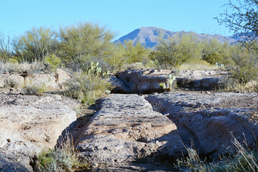
Rather than hike directly southward to the Apache Tears Mine, I walked north another 10 or 15 minutes to see the area where the metal-rimmed wheels of the ore-laden wagons travelling to Pinal City from Silver King Mine had cut deep ruts into the soft volcanic tuff. I stood for a few minutes and listened, straining to hear the long-ago clopping of the mules’ hooves as they pulled the creaking wagons toward the mill. Unfortunately, my imagination was subsumed by the whooshing of traffic on Highway 60 a few hundred feet away.
I backtracked to Pinal City and continued south, passing through another riparian area as I hopped across Queen Creek on a series of thoughtfully placed concrete blocks. Back in the sunshine, and despite it being the middle of winter, I was able to comfortably remove my hat and outer layer as I faced the hike’s modest elevation gain, walking uphill as I enjoyed spectacular views southwest toward Picketpost Mountain and east across the airport toward Superior and Apache Leap.
Near the top of the short uphill section, I came to a group of big boulders and a gate to the left. The LOST signs pointed southward, but the coworker who suggested the hike had advised me that to access the Apache Tears Mines, I needed to go around the gate and take the trail to the right immediately on the other side.
The trail skirts the west side of a small hill, and it wasn’t long before I reached the main area where manic digging for black obsidian had occurred in the past – it’s now fenced off with signs warning about the dangers of rockfall from above. But searching the rocky debris around the mine site, I was able to pick out a few small flakes of black obsidian, dark against the ground but translucent when held up to the sunlight.
As I was scanning the ground for rocks, I was joined by a fit, fast-walking, fast-talking 60-something hiker who was trailed at some distance by her 30-something son – he was panting just to keep up with her. We talked for a while about the beauty of the day and the history of the region.
Then the woman asked if we wanted to see something she had been shown on her previous hike to the area 10 years before. She led us on a short side trail that I hadn’t even noticed. We rounded a bend and came to dead end, where a rusted iron door was set into the cliffside. It looked like a secret side entry into the Mines of Moria or some other strange world. The door was unlocked, so I pulled at the handle. It was heavy and, groaning on its hinges, opened slowly and reluctantly. I stuck my head inside to find a small, empty room carved into the hillside.
The woman had no idea about the room’s purpose. A Globe native later told me – she wasn’t sure whether this was true – that it might have been used decades ago as storage by entrepreneurs who sold black obsidian to tourists. I also read somewhere that the Apache Tears story had possibly been invented as a marketing gimmick by sellers of black obsidian, so perhaps those people were one and the same.
I’m sure somebody knows the real history, or something close to it, but on the day of the hike, the iron door was just one more mystery to mull over as I retraced my steps down the hill, over Queen Creek, past the ghosts of Pinal City and back to my car.


